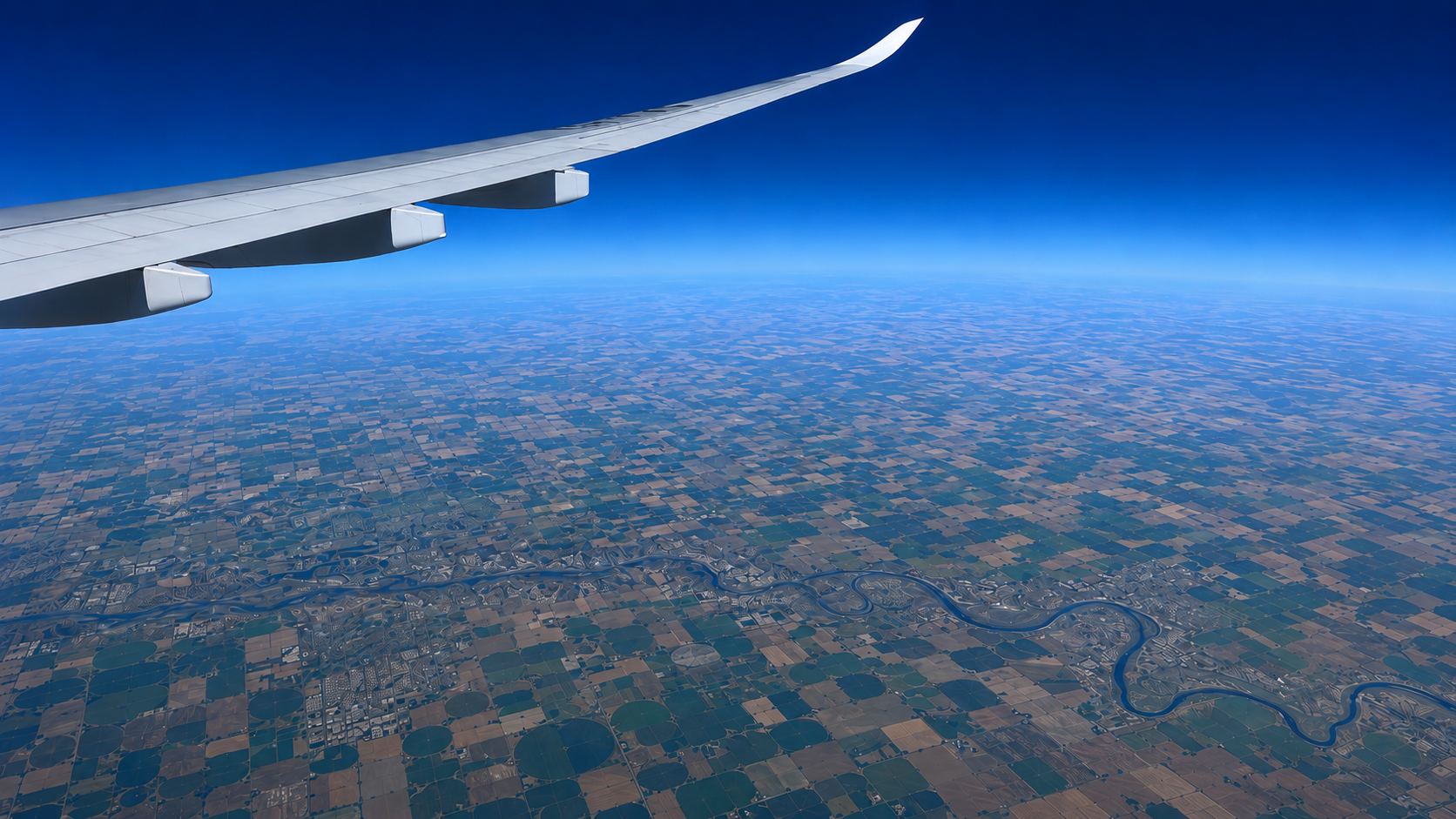
Farmland seen from an aeroplane window: a patchwork of fields and a winding river under a deep blue horizon

608 million farms. The food of every generation to come.

With climate change, decisions in the field have to be guided by data. That is where Agorà — the Agritech Oracle — was born.

608 million farms worldwide · FAO estimate

From forecast to millimetres

Agorà: a digital twin of soil, plant and atmosphere.

It reads the weather observation and forecast for your exact field and simulates how water moves through the soil and the crop. What comes out is one simple number: how many millimetres to give today, tomorrow and the day after.

  • Sensor-less
  • 3-day horizon
  • 40+ crop models
  • Any soil, worldwide
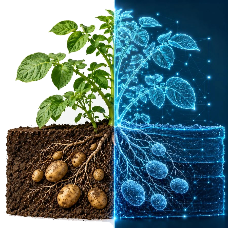
A potato plant shown half as a photograph and half as its digital twin, roots and tubers in the soil
Aerial view of farmland

Nothing is loaded from YouTube until you press play. Open it on YouTube.

See it working

Agorà Studio, all you need in one place.

One portal that opens on what you do: farmers get the irrigation advisor, with fields, soils and crops in one place; agronomists simulate climate scenarios and run the model directly; students learn irrigation decisions with AgriTwix; developers test the API.

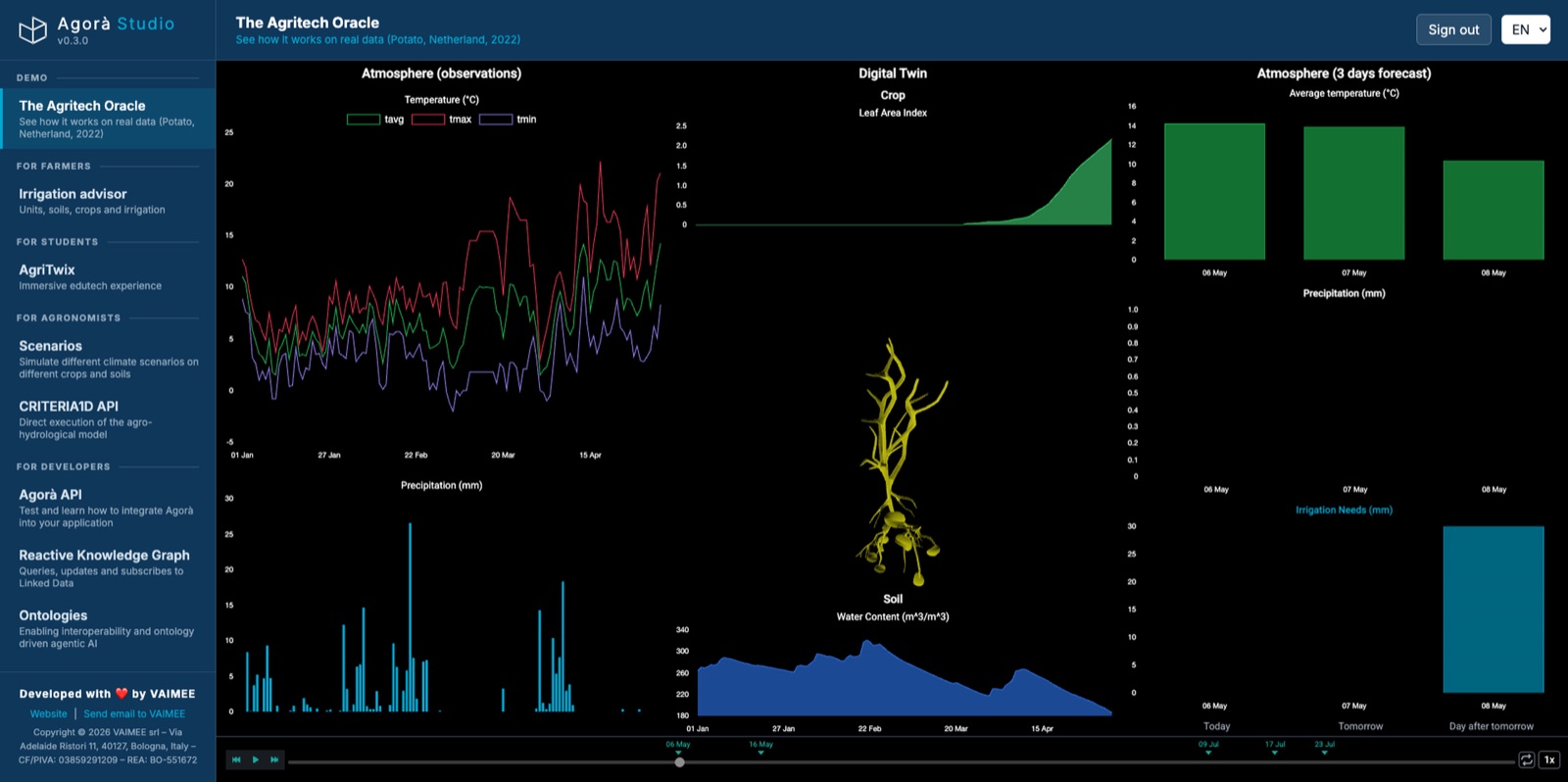
Agorà Studio home: the Agritech Oracle demo replays a potato season in the Netherlands, with the weather, the crop and soil twin, and the irrigation forecast side by side.
Agorà Studio One place for every experience
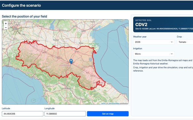
  • Scenarios: a map of Emilia-Romagna with a pin on the field, the soil detected there, and the weather year, crop and irrigation to simulate.

    For agronomists

    Explore every scenario

    Simulate crop and soil responses under different climate conditions.

    Scenarios
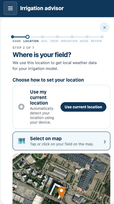
  • Irrigation advisor on a phone: step 2 of 7, “Where is your field?”, set from the current location or by tapping the field on a satellite map.

    For farmers

    Smarter irrigation, simpler decisions

    Turn crop, soil and weather data into actionable irrigation guidance.

    Irrigation advisor
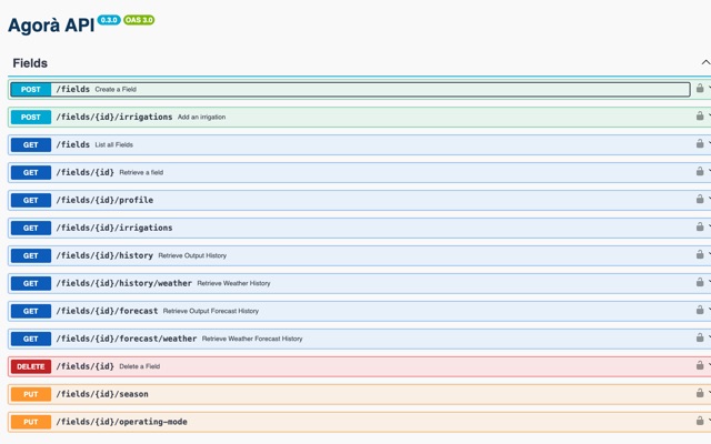
  • Agorà API reference: the Fields endpoints, from creating a field and adding irrigations to reading its history and forecast.

    For developers

    Build beyond the platform

    Integrate Agorà capabilities into your own applications and services.

    • REST API
    • Linked data
    • Knowledge graph
    Agorà API
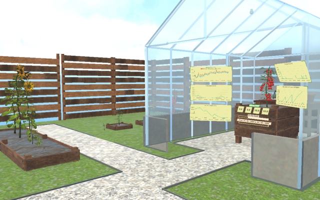
  • AgriTwix: a 3D garden with sunflowers in raised beds and a greenhouse where a tomato plant grows beside its weather and water charts.

    For students

    Experience agriculture differently

    Discover agriculture through interactive and immersive learning.

    AgriTwix

It learns from farmers

Semantics, physical models and AI — with the farmer in the loop.

Agorà combines a knowledge graph, validated physical models and AI. Every time a farmer tells it what they actually did and saw, it learns — adapting to their context to give the best irrigation advice.

It talks through the channel that works best for each farmer

  • Mobile app
  • SMS
  • WhatsApp
  • Telegram
  • WeChat
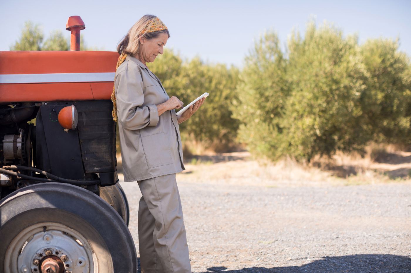
A farmer reading irrigation advice on a tablet beside her tractor, olive trees behind her

AI weather models

The forecast it starts from keeps getting sharper

A water balance is only as honest as the weather it begins with. Agorà draws on AI weather models that run a global forecast in minutes instead of hours and resolve it to a few kilometres, hour by hour — so the three days ahead keep moving closer to what actually falls on your ground.

NVIDIA Earth-2 · Google WeatherNext 3

Physical model

A water balance you can check

A validated soil–crop–atmosphere simulation tracks the water in the root zone day by day — rain, transpiration, drainage — so every number has a physical reason behind it.

CRITERIA1D by ARPAE · AquaCrop by FAO

AI

Learns from every farmer

Farmers confirm what they applied and flag what they see. The AI learns from that feedback and tunes the model to each field — the longer it runs, the closer it gets to reality.

The physics stays the backbone, so advice stays explainable

From advice to action

When the farmer says yes, Agorà can open the valve.

Agorà can control irrigation directly — only when a remote LoRaWAN valve is installed and the farmer authorises the action. The farmer answers from the sofa; the valve is twelve kilometres away. Agorà asks, then does the work, then reports back.

Agorà 06:04

Good morning. Field 4 (potato) needs 15 mm today. Shall I open the valve?

You 06:11

Yes, go ahead.

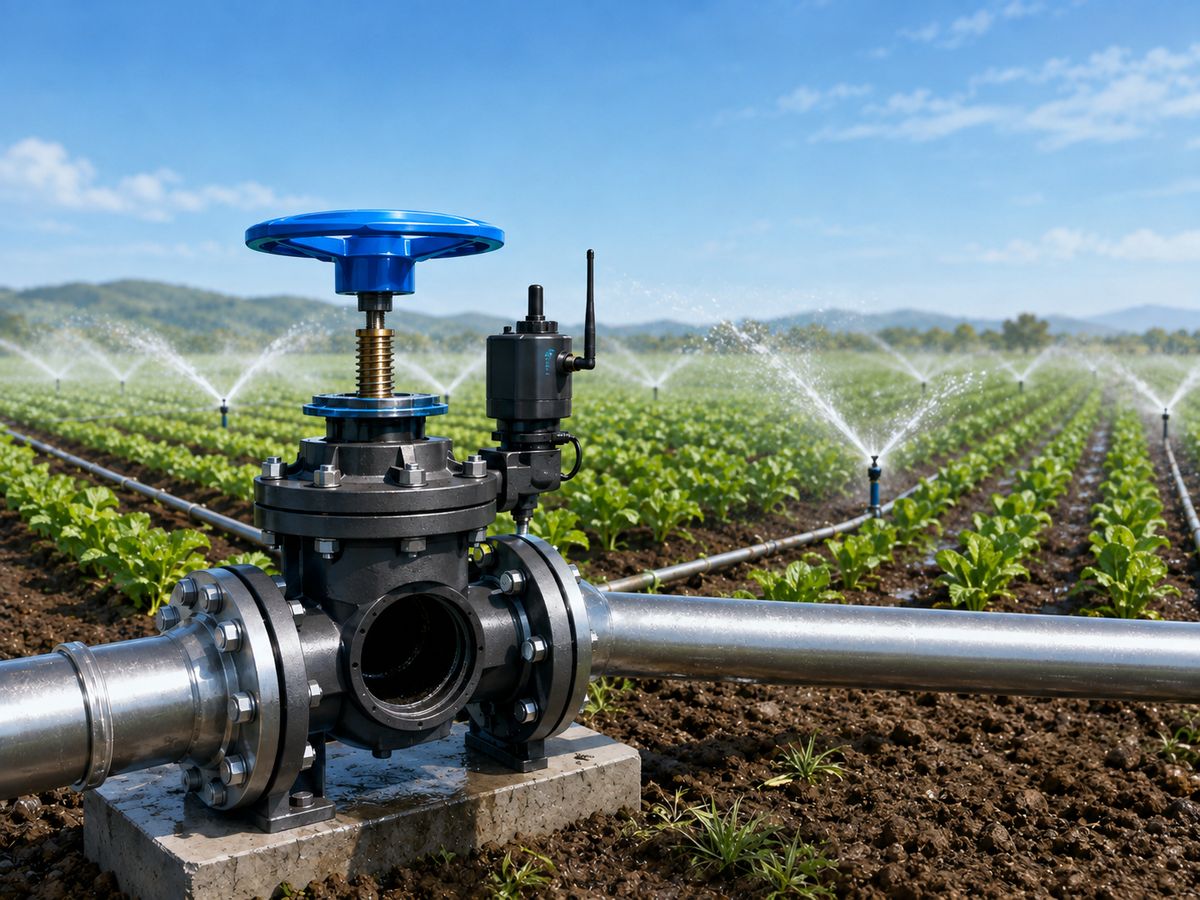
A farmer sitting on his sofa at home, confirming the irrigation on his phone 06:11 · “Yes, go ahead” An irrigation valve in a vegetable field with sprinklers running Valve open · 15 mm
He says yes from the sofa; the valve is twelve kilometres away.

Agorà 08:47

Done. 15 mm on field 4, valve closed. Tomorrow’s balance starts from there.

ILLUSTRATIVE CONVERSATION

From research to the field

Twenty years of agronomy, in one number a day.

Agorà started as a response to climate change and water scarcity, built on decades of research and real-world testing. We wrote up how it works on potatoes — read it and judge for yourself.

White Paper

Can a model reproduce sensor-based irrigation decisions?

Validation of the AGORÀ irrigation model against sensor-based irrigation management in commercial potato production

Free assessment

Already efficient? Let’s check which irrigations really mattered.

Send us your previous seasons’ irrigation data. Agorà replays them and returns a water efficiency assessment: where you were in the optimal range, where water was short, and where it was wasted.

Because the question is not only this year. What if next year you don’t have the water you had this year?

Proven where water is used best

Three years with Royal Agrifirm, in the country that gets the most from every drop.

We co-designed and validated Agorà with Royal Agrifirm — a Dutch cooperative of more than 7,500 members — on potatoes, onions and tulips. The Netherlands leads the world in water-use efficiency. If Agorà adds value there, it adds value anywhere.

Water-use efficiency · US$ of value per m³ of water

  • Netherlands29
  • Slovenia7
  • Switzerland6
  • Germany3
  • France2
Selected countries. Source: FAOSTAT.

Track record

Who we have worked with along the way.

Research institutes, companies, European projects and programmes we have built with since 2020 — some current, some finished.

  • Customers & industry
  • Royal Agrifirm Group
  • METER
  • Siemens
  • European projects
  • HARMONI
  • I3-4-BIOFERTILIZERS
  • XR4ED
  • NGI ONTOCHAIN
  • NGI DAPSI
  • Nephele
  • EIT Deep Tech Talent Pledger
  • SUAVE
  • Programmes, accelerators & facilitators
  • NVIDIA Inception Program
  • Ecosister
  • ART-ER
  • Impact Deal
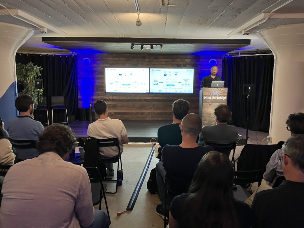
  • Mind the Bridge
  • agrifoodTEF
  • Fondazione Bruno Kessler
  • Tecnopolo Reggio Emilia
  • Tecnopolo Forlì-Cesena

These names and logos record the realities we have been and are in touch with, through projects, pilots, programmes and competitions. Not all of them are current partnerships, and none of them implies an endorsement of VAIMEE or Agorà. Every logo remains the property of its owner and is shown for identification only.

Explore further

The rest of the story

Our deep purpose Secure food for us and future generations.

Farmers need accessible solutions to adapt to climate change. Water is the first thing it takes away — and the one input no farm can afford to waste.

So Agorà is built to be within reach of every farm: no sensors to buy, a price a smallholder can pay, and advice that arrives on the phone the farmer already carries. We can’t create water. We can help use it wisely, when it is available.

Working towards the UN Sustainable Development Goals

  • Goal 6: Clean water and sanitation
  • Goal 9: Industry, innovation and infrastructure
  • Goal 11: Sustainable cities and communities
  • Goal 12: Responsible consumption and production
  • Goal 13: Climate action
  • Goal 17: Partnerships for the goals
The daily decision When to irrigate? How much water?

Two questions every irrigated farm answers, every day of the season. The right answer balances water, yield and costs.

What the decision depends on

  • Soil
  • Crop
  • Weather
  • Growth stage

The decision

When to irrigate?

How much water?

What it decides

  • Yield
  • Quality
  • Water efficiency
  • Energy costs

The yield curve

Too little water costs yield. Too much costs everything else.

Past the optimal range, extra water doesn’t raise the harvest. It wastes water and energy — and can even reduce yield.

The goal: irrigate at the right time, with the right amount — the best result with minimal waste.

The yield curve Yield rises as applied water increases, peaks in an optimal range, then flattens and falls when water is in excess. Yield Applied water Water deficit yield loss Optimal range maximum yield, efficient water use Excess water waste, possible yield loss
The solution From a pair of coordinates to a three-day irrigation forecast.

Give Agorà the position of a field. It picks the best local data and the best model for it, and runs a digital twin of the soil, the crop and the atmosphere above them.

Input

  • Latitude, longitude Required
  • Sensors and devices Optional
  • Satellite In progress

Digital twin

Hyper-local data

For each field, Agorà selects the best weather service and soil data provider available.

Soil–crop–atmosphere model

It selects the best model for the case, from CRITERIA1D by ARPAE Emilia-Romagna to AquaCrop by FAO.

  • 40+ crop models
  • Knowledge graph
  • AI calibration

Output

  • Irrigation forecast Available
  • Crop yield Coming soon
  • Nitrogen emissions In progress
How it works A year of history, then a new run every day.

Agorà starts from one year of daily temperature and rainfall, plus the features of the soil, the crop’s water needs and irrigation method, its cycle and root development, and how water infiltrates. Then it runs every day.

Every run returns a full water balance

Not just a number to irrigate: the terms behind it, for each of the next three days. Agronomists can check every one of them.

  • Irrigationmm
  • Reference evapotranspiration (ET0)mm
  • Max transpiration · transpirationmm
  • Max evaporation · evaporationmm
  • Leaf area index (LAI) · crop coefficient (Kc)–
  • Soil water contentm³/m³
  • Surface water contentm³/m³
  • Lateral drainage · surface runoffmm
  • Root depthm
Model parameters What the twin knows about your field.

Soil comes from digital soil maps or sampling. The crop comes from a library of 40+ models. The farmer’s feedback keeps both honest.

Soil

Features of the soil

Number of horizons and their depths, coarse fragments, organic matter, texture (sand, silt, clay) and bulk density.

Soil

Infiltration

Maximum infiltration and the water retention curve of each soil layer.

Crop

Crop cycle

Sowing day, maximum cycle length, leaf-area parameters, thermal thresholds and degree-days for emergence and leaf growth.

Crop

Root development

Initial and maximum root depth, and root shape.

Crop

Water need

Crop coefficient, leaf water potential, stress tolerance and fraction of readily available water.

Irrigation

Irrigation

Irrigation shift and volume, degree-days to start and end irrigation, and the most sensitive growth stage.

What a unit is Agorà works one unit at a time: one crop on one soil.

A unit is a georeferenced plot with the same soil and the same crop — the area where one irrigation decision is right for all of it. A field with two soils on it counts as two units.

Geo-coordinates+Soil+Crop=1 unit

Not every system can water zones separately — a hose reel, for one, covers the field evenly. Tell us how you irrigate and we will work out the most efficient way to turn the advice into water on your own equipment.

Counting units on a farm A farm seen from above: two parcels, wheat and corn, split by a track, with five soil zones sweeping across both regardless of the field boundaries. Every overlap of a parcel and a soil is one unit, marked with a dot: nine in all. Soil 1 Soil 2 Soil 3 Soil 4 Soil 5 Wheat Corn
Example: a 10 ha farm with two fields — wheat and corn — across several soil profiles counts as 9 units.
Unique features What makes Agorà different.

Pathway to sustainability

Records that support certification such as SPRING — the Sustainable Program for Irrigation and Groundwater Use by GLOBALG.A.P. — and Goccia Verde.

Open and reliable

Built on open-source, validated models such as CRITERIA1D by ARPAE Emilia-Romagna and AquaCrop by FAO — transparent and trustworthy, not a black box.

No sensors needed

Agorà works without in-field hardware. Where soil moisture sensors, CRNS or satellite data exist, it can use them as additional inputs.

Multi-scale approach

From a single plot to an entire region, Agorà adapts to your scale and delivers precise advice whatever your context.

Drop by drop

Making every drop count.

Join us to create a worldwide impact — whether you farm one field, advise a hundred, or build the tools they use.

A young shoot in dry soil, catching drops of irrigation water